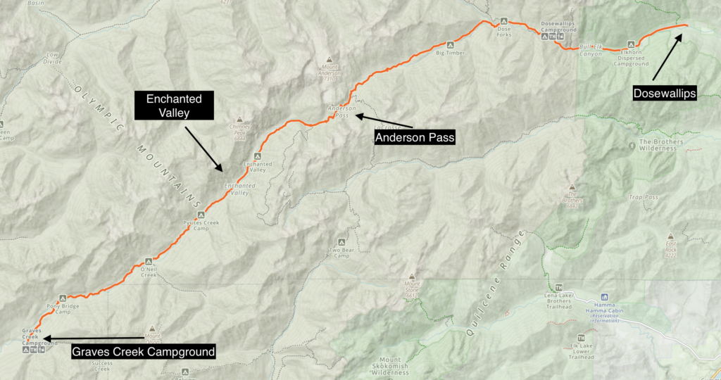
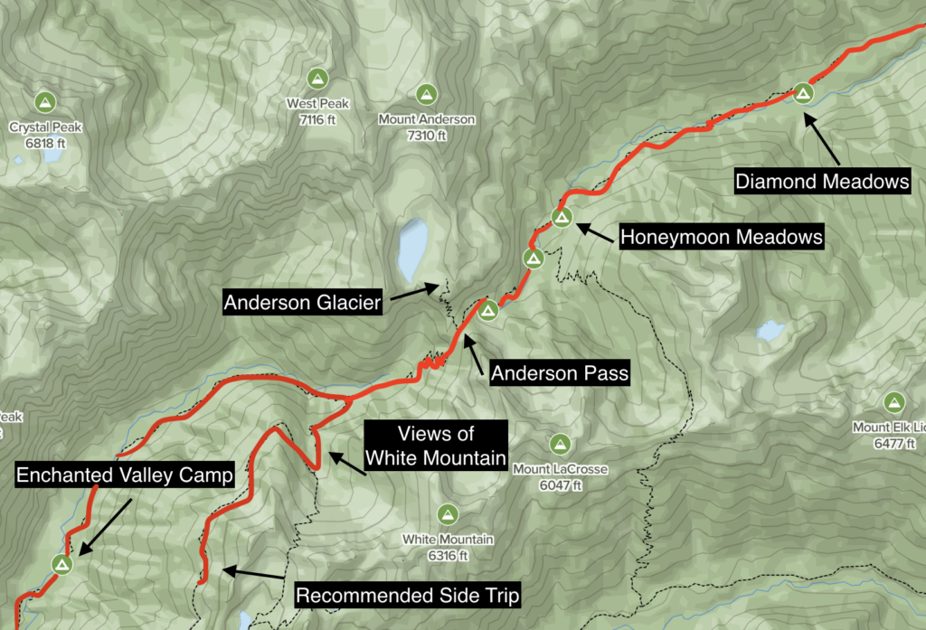
Trail: Graves Creek to Dosewallips Trailhead
Highlights: Enchanted Valley, White Mountain, Views from the ridge-line above Enchanted Valley, Anderson Pass, Honeymoon Meadows, Diamond Meadows, Dosewallips Ranger Station
Night 0: Graves Creek Campground (trailhead), Night 1: Enchanted Valley Campground, Night 2, Honeymoon Meadows, Night 3: Diamond Meadows, Day 4: exit at Dosewallips
Stats: ~35 Miles, ~5500 Elevation Gain (depending on side trips), ~4 days recommended to complete
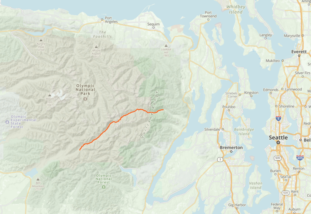
And here below is the hike in the greater context of the Olympic Peninsula and Washington State
Olympic National Park offers a diverse trail system from mossy rainforests all the way up to snow covered peaks. My goal was to find a route in which it was possible to thru-hike the park point to point while seeing as much as possible that Olympic National Park could offer. With the park covering nearly a million acres across the entire Olympic Peninsula, I knew it would take years to see everything, but this time around I settled on a backpacking trip from Lake Quinault area in the southwest all the way to Dosewallips trailhead in the east. This hike would include the coveted Enchanted Valley and a climb over Anderson Pass. My theory was that some of the most beautiful vistas were in the center of the park where the surrounding mountains could be best enjoyed, outside of day hiking territory.
Trip Reports and Resources
Here’s some quick resources, including an alltrails page that matches our main route (in reverse):
Dosewallips River Trail to Graves Creek via Anderson Pass and East Fork Quinault River Trail
Trip reports for the enchanted valley area are also available on Washington Trails Association (WTA)
National Parks Service – East Fork Quinault River Trail
From what I can tell, the elevation gain is around 5,500 (we didn’t climb up to Anderson Glacier) and the distance is about 35 miles. Everyone in our group found this trip to be reasonable over 4 days – but as always, know your limits and be prepared. The ideal season for mountainous areas like Olympic National Park would be July-September. It worked out for us despite scheduling this trip right as the snow was melting in mid-June.
Wilderness Permit and Logistics
We reserved our backcountry campsites nice and early, only shortly after the booking system became available. We heard through other backpackers that this year (2021) was the first year that a quota system was introduced due to covid. There were no walkup permits available, so we took advantage when we saw that a spot at Enchanted Valley was available on a Thursday night.
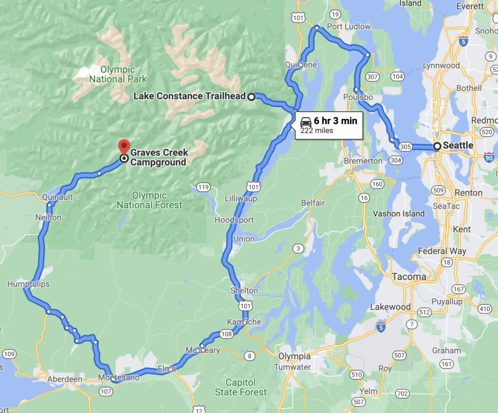
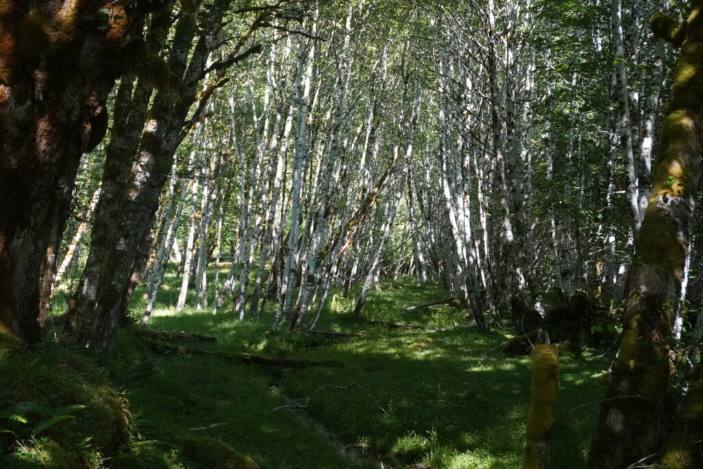
To make this trip happen we needed two cars, leaving one at the Dosewallips trailhead, and we were lucky enough to have a friend shuttle us all the way around to Graves Creek Trailhead. Normally we would have collected our permit at the wilderness information center by Lake Quinault (or Port Angeles) on the way in, but this year due to covid, we just printed our permits out at home. Our first night we car camped at Graves Creek Campground which was first come first serve. What I didn’t realize was that it would take a solid 45 minutes just to get from Lake Quinault to the trailhead . We followed South Shore Road which turns into the gravel Graves Creek Road. The approach along the Quinault River Valley was worth it. When we arrived, there were plenty of available spots on a Wednesday. The campsite was beautiful, with moss hanging down from the trees. Although we weren’t directly in the well-know Hoh Rainforest, the Quinault Rainforest surprised me with what it had to offer.
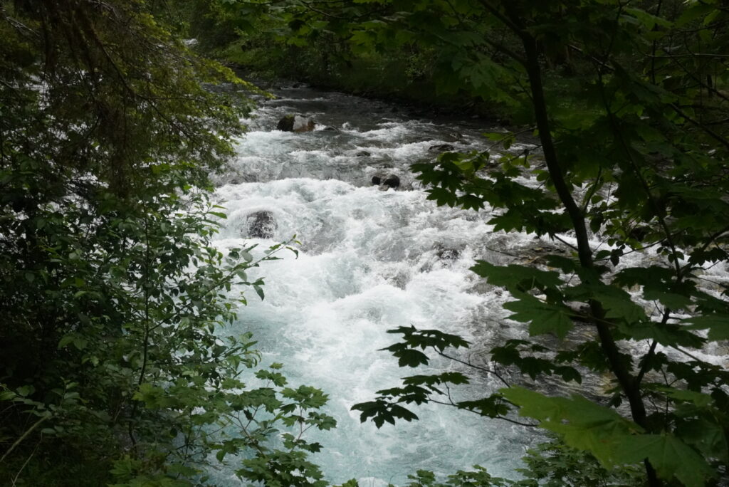
The next morning, I walked down to the river bank of the Quinault River to take in the sounds and scenery. We anticipated great weather, but I still packed rain gear including my rain jacket because you never know what to expect up in the mountains.
Graves Creek Trailhead and Enchanted Valley Trail
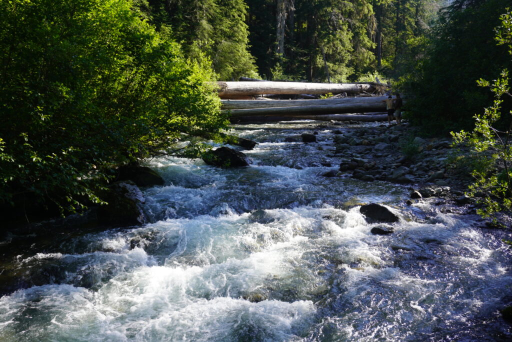
After a nice, car camping breakfast, we set out across the Quinault River Bridge which would serve as the Enchanted Valley Trailhead. Our first day of hiking we mapped out that we would be hiking about 12.9 miles along the Quinault River to reach Enchanted Valley. We embarked on a gentle climb through dense forest into a deep glacial valley. This day proved to be the most challenging, as our packs were full, and the entire day was uphill. However, 13 miles is extremely do-able. The trail crosses several campsites including O’Neil Creek Backcountry Camp and Pyrites backcountry camp (Pyrites Creek). In addition, there are some minor stream crossings, including a narrow bridge over no name creek as well as Pony Bridge.
The campgrounds available on the way to Enchanted Valley could be used for a more casual approach or for low elevation camping in the off-peak season. I would recommend sending it directly up there and spending as much time as possible in the valley area. On our way up, we did end up running into a ranger that checked our permits.
Enchanted Valley – Olympic National Park
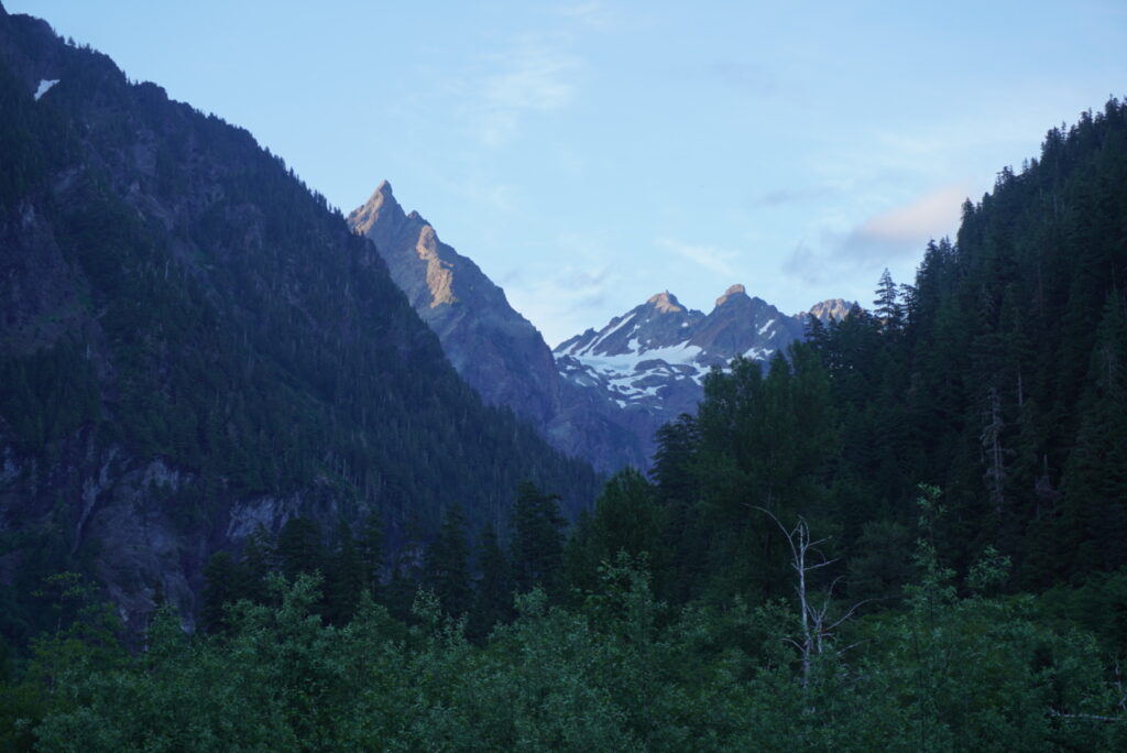
The Enchanted Valley absolutely blew me away. Enchanted Valley Olympic National Park has to be my favorite destination I’ve visited in the Pacific Northwest. You’ll have to see it one day for yourself. Our hike was in mid-June, and the snow was still melting off the tops of the mountains. We could look up and see this beautiful rock wall and Olympic Mountains that went on for miles hanging over the Quinault River.
Each of us brought bear canisters on this trip. While there were bear wires at most of the campsites, we found it easier to not have to rely on them. Definitely check the bear wire situation if you plan to rely on them by calling into the ranger station before your trip. I recommend just making it easier on yourself and bringing a bear canister. There are black bears in the Enchanted Valley area. We hadn’t seen a black bear before, so we double checked with the ranger that was camping in the area to get an idea of how we should behave if we saw one. The ranger said that although there were bear sightings in the area, black bears are not dangerous, and it’s very unlikely they would attack a human. What you do have to worry about is securing your food because any black bear will try to get into it.
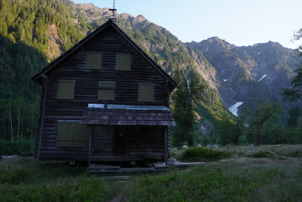
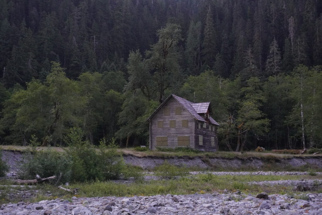
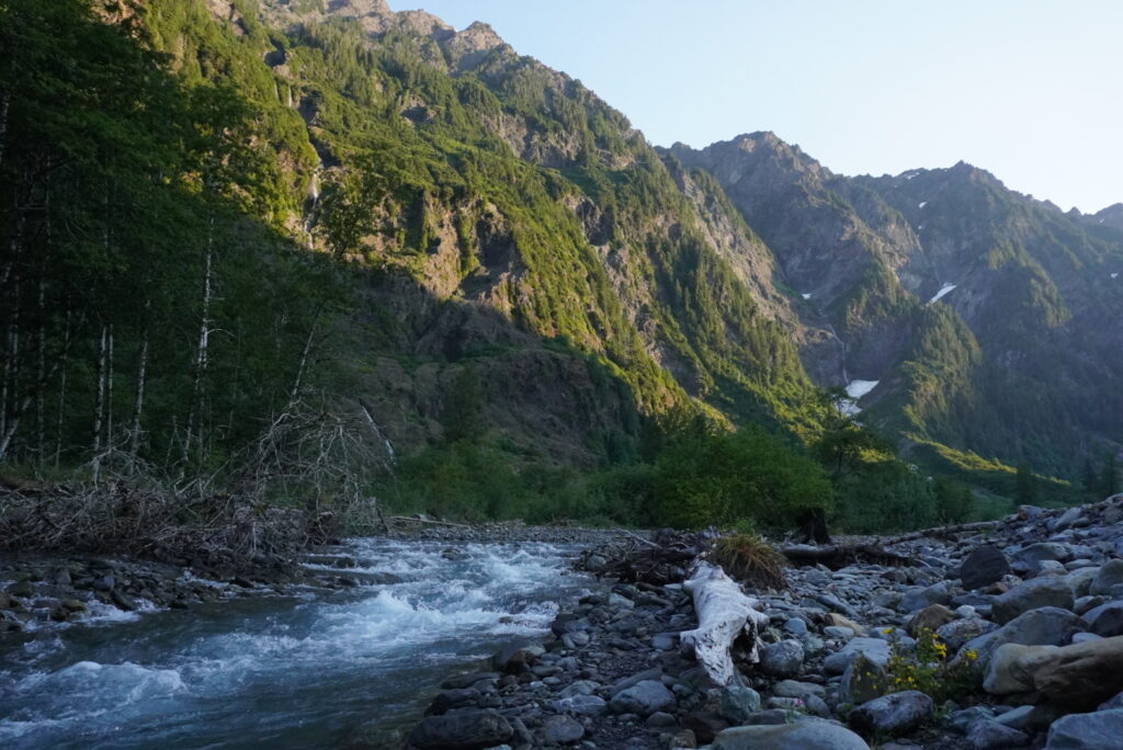
Along the flood plain of the East Fork of the Quinault River is the Enchanted Valley Chalet. The structure is a rustic style Ranger Station that got put out of commission because the entire structure is sitting right on the ledge of a bank that is heavily eroding. This historical chalet originally served as a retreat for hikers and horseback riders in the 1930s, and during World War II it even served as an Aircraft Warning Service Station. The rangers told us that the park already moved the entire structure of the Enchanted Valley Chalet backwards to prevent this from happening. Its a bit tragic to see the Enchanted Valley chalet nearly ready to collapse into the East Fork Quinault River, but it sure makes for some nice pictures.
Anderson Pass Day
Our original plan for today was to make our way all the way up to Marmot Lake and complete the “lollipop loop”. We checked some trail reports to get a gage on trail conditions and found that we were a bit early in the season to reach the Marmot lake portion of the hike, especially with snow conditions still a little bit dangerous over 5000 feet. We didn’t know what to expect, but we wanted to get to higher ground and experience Enchanted Valley from above. Our plan was to check out the conditions and see how far we could get without microspikes.
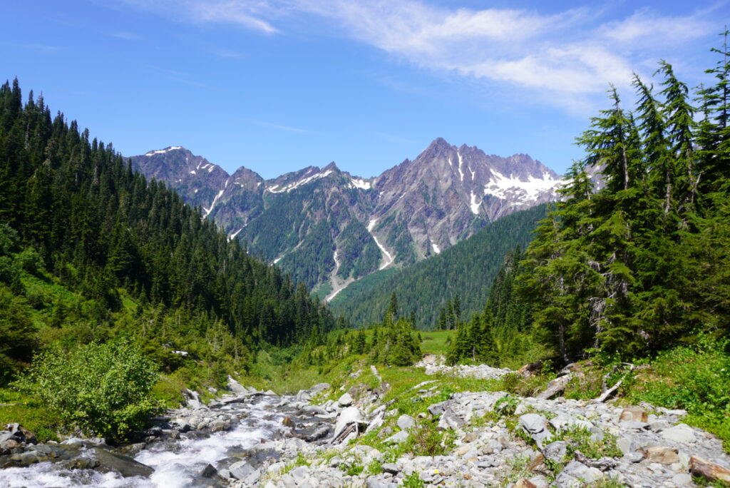
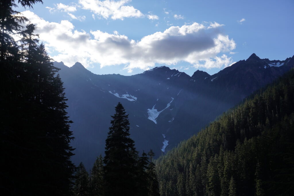
We left Enchanted Valley early, and as we ascended from the valley floor, we ran into the worlds largest Western Hemlock. The old growth in the area reigned supreme. The trail continues as a gradual climb up to a trail junction where we decided to turn off to head up to White Mountain area. At this point we were just exploring more than anything. As we came to a clearing, I had to stop and take pictures because the views were absolutely fantastic in every direction. I highly recommend White Mountain as a day hike option from Enchanted Valley. We anticipated having to ford a river in order to continue on, but the water levels were rather low at this time.
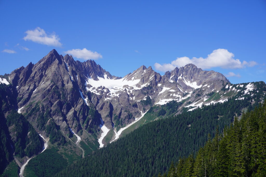
We made a plan to stop for lunch and drop our packs in the woods so we could fit in a mini day hike to catch some of the better views of Enchanted Valley. My brother unfortunately had a mishap by dropping the cap of his bear canister which conveniently rolled down the hill a little ways. We were able to scout out down below retrieve it. Retrieving the bear canister was our only option as we didn’t bring backup equipment to hang our food in the bear wires or in a tree. We continued on for our mini hike, and since I didn’t have an extra day pack handy, I carried my camera, water bottle, and snacks individually in my hands. There were several spots with downed trees which we had to navigate, but it was manageable. Eventually, the trail began to open up and reveal views of those same mountains standing over Enchanted Valley, but this time with a much more striking birds eye view. We took our sweet time on this stretch, stopping just to enjoy slight changes in the view around every turn.
The mountainside was steep, and the slope below the trail was quite a long way down. We reached the first snowy section. I did have some treads that I bought at REI, but the slope down below wasn’t the most comforting. I suppose mid June is considered early summer for the mountains, as the snow was clearly still present. This was the exact scenario that I would have preferred to have an ice axe – to stop myself from sliding in the case that I slipped. In another couple of weeks, I imagine we would have been fine making it through this stretch. The snow melt is different season to season both on the Olympic Peninsula and in other high elevation National Parks. Without good information from trip reports, we wanted to play it by ear on this stretch and we ultimately decided to turn back and call it good.
After snagging our backpacks that we left behind some fallen trees, we approached White Mountain again and in the distance we saw a black bear moseying around right on the main trail. There was no backup camping option or even emergency shelter behind us, so the only way to go was forward. The bear was hanging out directly in the only campsite in the area. With no other backpackers visible, we didn’t want to stick around. Although I didn’t have a lot of experience with bears of any kind, I figured that we could have made some noise and tried to get around it. Understandably, our group didn’t like that plan, so we tried to wait out the bear, but it seemed to just ignore our presense. Although the foliage was thick and the ground was pure mud, we made the choice to venture off trail a bit to sneak around it. It was getting late, and we still needed to send it over Anderson Pass to get to our stopping point for the night – honeymoon meadows. Water was becoming a bit scarce, but we knew we could rely on a water source at the trail junction that links backup with the main trail up over the pass.
We kept our water fill up break short, as the sun was starting to come down below the tips of the Olympic Mountains . The trail climbs steeply up the hill, and I stopped once or twice to stuff myself with snacks.
At the top, we knew there was a side trail up to Anderson Glacier, but the ranger told us that there wouldn’t be much to see – just a small snow field. Other backpackers were worried the Anderson Glacier/Pass area might require an ice axe, but at this time it was easily passable. We felt rewarded to reach the halfway point in our journey knowing it was all downhill from here to Dosewallips.
Honeymoon Meadows & Diamond Meadows Campgrounds
We descended down to Honeymoon meadows as dusk fell on us. The meadows were gorgeous, and after a long day, a wide river stood between us and the campsite. Impatient, and wanting to see how my waterproof trail runners would hold up, I walked across the river with shoes on. (I regretted this later). There were plenty of spots with bare ground at the campsite, and we quickly got dinner going and tents setup for the night. It’s worth noting that we had to continue on to Honeymoon meadows because this was the first campsite with a water source following Anderson Pass. The meadows here are also gorgeous so it works out in all facets. I wouldn’t recommend staying at Camp Siberia if that can be avoided.
The next day would be our slowest and most relaxing. We planned to hike only 3 miles downhill to Diamond Meadows. The trail starts below treeline which was nice for the sun cover. We found ourselves walking through muddy stream runoff at times. We arrived in just over an hour at the Diamond Meadows campsite. I took a nap and later we joined up at a nearby river for a dip.
After plenty of time to rejuvenate in the old growth forests, we agreed to hike all the way out to the car the next day instead of staying at a cutoff campsite called Big Timber.
Dosewallips River Trail
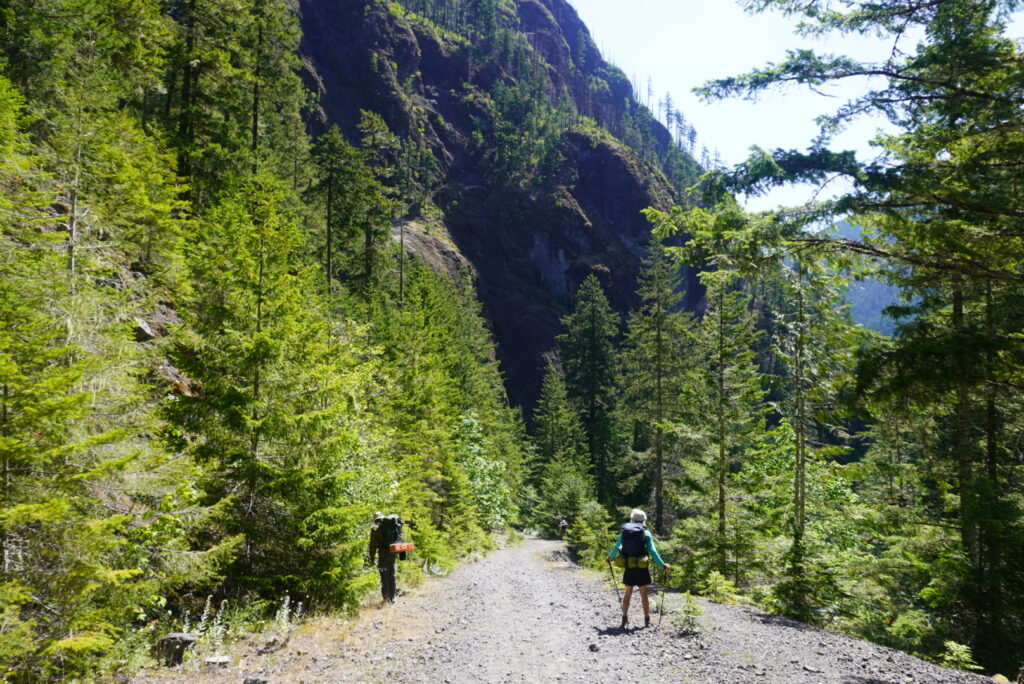
The Dosewallips Ranger Station was abandoned, which was a shame because the area was extremely beautiful. Similar to Graves Creek, there was moss hanging from the trees, and I could have seen myself staying here. As expected, the last 6 miles or so were road walking on a gravel path, but there was no chance to see cars as there was at least one blow down that was left as is. This east side of Olympic National Park is enjoyable because the trees stand so tall and the mountains stretch for miles on end. The trail followed a ledge that overlooked the Dosewallips River that roared as we descended all the way down to the parking lot. In the last half mile, the rest of my group decided to run the remaining trail while I took it easy and enjoyed the final moments.
We were all pleasantly surprised at all the incredible destinations this hike offered. This was one of the highlights of my Summer among many backpacking trips. Get out there and enjoy Olympic National Park!