Chinese Wall Loop – Bob Marshall Wilderness
Stats: 75 miles, 7500 ft elevation gain
Highlights: Chinese Wall, Red Butte, White River Pass, Haystack Mountain, Larch Hill Pass, My Lake
Night 0: Benchmark Campground, Night 1: Indian Creek, Night 2: Haystack mountain junction, Night 3: Brushy Park, Night 4: My Lake, Night 5: Indian Creek, Day 6: Exit at Benchmark trailhead
This trail is an ambitious 75 mile loop through unexpectedly spectacular Bob Marshall Wilderness. The distance alone on this trail will test your backpacking skills and fitness, but the rewards are spectacular. Our entire group agreed that this trail offers National Park level views, with the benefit of not requiring a permit as of our hike in Summer 2021 (we expect that to change). In our particular case, a fire in the town of Polebridge, MT caused us to change our plans for hiking Glacier National Park, and we stumbled on this amazing backpacking trip.
Grizzly Country – The Bob Marshall Wilderness
The header says it all. If you plan to come backpacking in Montana, be prepared to take your bear safety extremely seriously. As always I would recommend a bear bin, and if you plan to hang your food, it better be a good hang (10 feet+ above ground and 10 feet + below the tree limb). We ran into some areas where there weren’t good spots to hang, so I was glad I had that bear canister. Definitely bring bear spray and have it easily accessible. Bear spray is a weapon, but you should absolutely have it. Avoid confrontations with Grizzlies at all costs. We didn’t see one on our trips, but we did see grizzly poop. A backpacker at one of our campsites mentioned that he came across a grizzly about 20 feet away while riding horseback. Take this seriously and you’ll be fine.
South Fork of the Sun River Trailhead / Benchmark Campground
The first night we drove into Augusta Montana and stopped for Dinner at Buckhorn Bar. Our plan was to camp the night at Benchmark campground and set out in the morning. We started this trip as an alternate due to fires. The air quality was a bit questionable, but there were no warning from the local ranger station regarding fire danger. There is a flat gravel road which takes you from the small town of Augusta over to Benchmark trailhead. As we drove in on Benchmark Road, the wildfire smoke was resting on the hills which gave us a bit of worry, but the forecast predicted a bit of rain overnight which would hopefully clear the smoke.
South Fork of the Sun River trailhead is the most popular entry point for the Bob Marshall wilderness. As soon as we arrived to our campsite, we could tell that the trail was heavily utilized by horseback riders. More on that later.
What makes this hike so long is that it takes 10-12 miles just to get into the areas where you want to be. With smoke still shrouding the view, we weren’t expecting much. But as we stretched out of the forest, we walked through valleys and rolling mountains. There are a couple of bridges on the way that cross over streams littered with fish. Several times we saw people fishing on the side of the South fork of the sun river, or hikers carrying their fishing pole down trail. “Any luck?” we would ask, and they always said yes. This entire area is a popular destination for fishing.
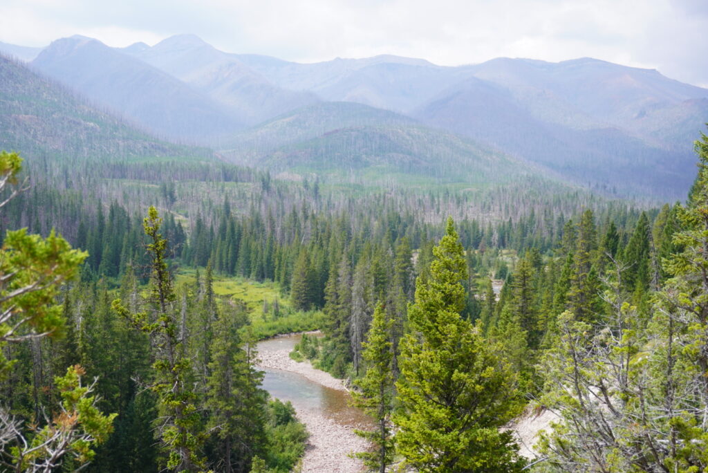
Later in the day we stopped by Indian Point Cabin, which appeared to be managed by the wilderness area. There were signs that we wouldn’t be allowed to camp here, but we decided to sit out on the patio to get some cover during a couple hours of pouring rain. The best part? There was an outhouse available for public use which would delay the inevitable of having to poop outside. Sitting in the outhouse was a vintage National Geographic magazine which kept us entertained as we relaxed. Our first campsite would be another 1-2 miles onward alongside Indian Creek. We stopped right before the junction to turn off towards White Creek Pass. The water source here was plentiful, and we could hear the pleasant sounds of the river as we slept.
Itinerary Breakdown
The loop we were going to tackle was gigantic compared to our past hikes. We decided to hike clockwise, traveling north behind the Chinese Wall first and then hiking back over Larch pass. Our itinerary from here we appropriately referred to as “1,2,3, Slam”. 1 being White Creek Pass, 2 being a day hike summit of Haystack Mountain to catch views from the top of the Chinese Wall, 3 being our ascent of Larch Hill Pass, and Slam referring to the 2 days when we plan to hike long days including ] the entire Chinese Wall, returning to the Indian Creek junction (our current location) and exiting on the final day.
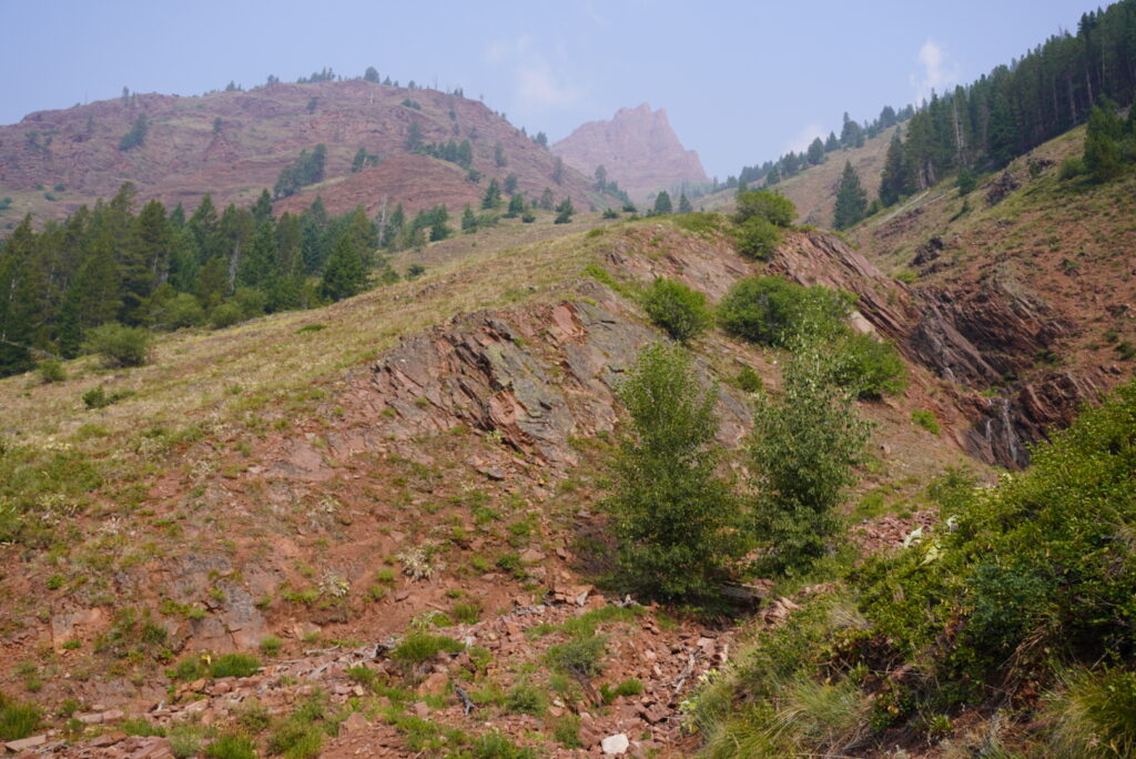
Red Butte & White River Pass
When we woke up in the morning, we could tell that the smoke started to clear, and I could see the sunrise and mountains peaking up through the trees. At the Indian Creek trail junction, we decided to turn west for a clockwise loop. Soon after the trail begins, we crossed the river via bridge – this portion of river predictably named – the west fork of the south fork of the Sun River. We continued west past Red Butte.
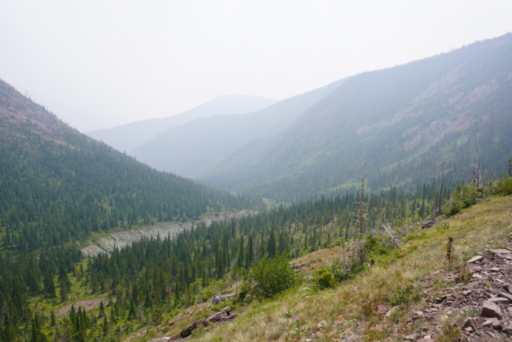
We also passed by the junction for a spur trail that led to a lookout called prairie reef. Back in the other direction we could have also potentially visited the Rocky Mountain area which includes additional destinations such as Gibson Reservoir and Pretty Prairie. Our plan for today was to continue on over White River Pass and potentially hit haystack mountain the following day as an excursion. For White River Pass, we were expecting about a 2000 foot elevation climb for this upcoming pass, and although we kept hoping that it would be easy, the climb was a bit more of a slog than expected with our exceptionally full packs. Upon reaching the pass, we took a rest and enjoyed the staggering backdrop of peaks that would stretch for miles.
This was a rewarding way to crossover the continental divide. We tried our best to name the peaks that were in sight, but it was difficult to get oriented on our maps. Our hike down to the valley below felt longer than we expected. This would turn out to be the theme of the trip. Eventually we wrapped around a large mountain and descended down onto White Creek at the bottom of the valley.
Based on a book we brought called “Hiking Montana’s Bob Marshall Wilderness“, we were hoping to find a wilderness outfitter that would allow us to use a pit toilet or other amenities. This was our planned camp location, but as it turned out, the outfitter was entirely blocked off by fence and rope, and they wouldn’t be as welcoming as we thought. There was a horse stable with dozens of horses here and tourists would ride in over White Creek pass to stay here. Horseback riders congratulated us for making it over the pass on foot. With tired legs, we searched for any available camping spot, and found a couple suitors across the river.
White River & Haystack Mountain
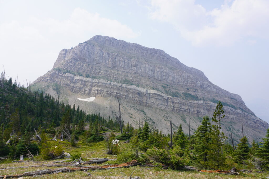
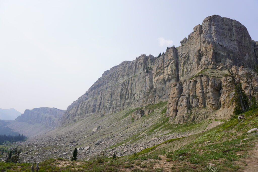
At this point we decided that we felt good and would try to summit Haystack Mountain the following day. We set an alarm for 4 am and headed out up the hill. To prevent wildlife from messing with our stuff, we left ur tents set up with our backpacks and gear inside. We had to retrace our steps and climb a ways up the river to reach the Haystack Mountain Junction. We hiked through dawn and enjoyed the quiet morning glow. On our way up, we ran into a pack of around 30 hours. The front and back horse appeared to be leaders and kept the pack together. They stopped and stared at us, waiting for instruction. With all these horses blocking the path, we stepped off trail and directed them to continue on and all 30 of them trotted past us in unison. We were confused to say the least. When the forest opened up, we found ourselves trudging long distanced on the longest, straightest switchbacks I’ve ever seen. The top of Haystack Mountain was magical, and we got our first view of the Chinese Wall.
This great wall stretches unbroken for over a dozen miles long. Every once in a while, a bi-plane would fly through to get a good look at the wall. By now we knew the Bob was one of the premier wilderness areas. For the remainder of the day, we joined back up with our main route, grabbed our stuff, and continued north for another 8 miles to reach our final camping spot a couple miles into the Brushy Park area.
Larch Hill Pass & My Lake
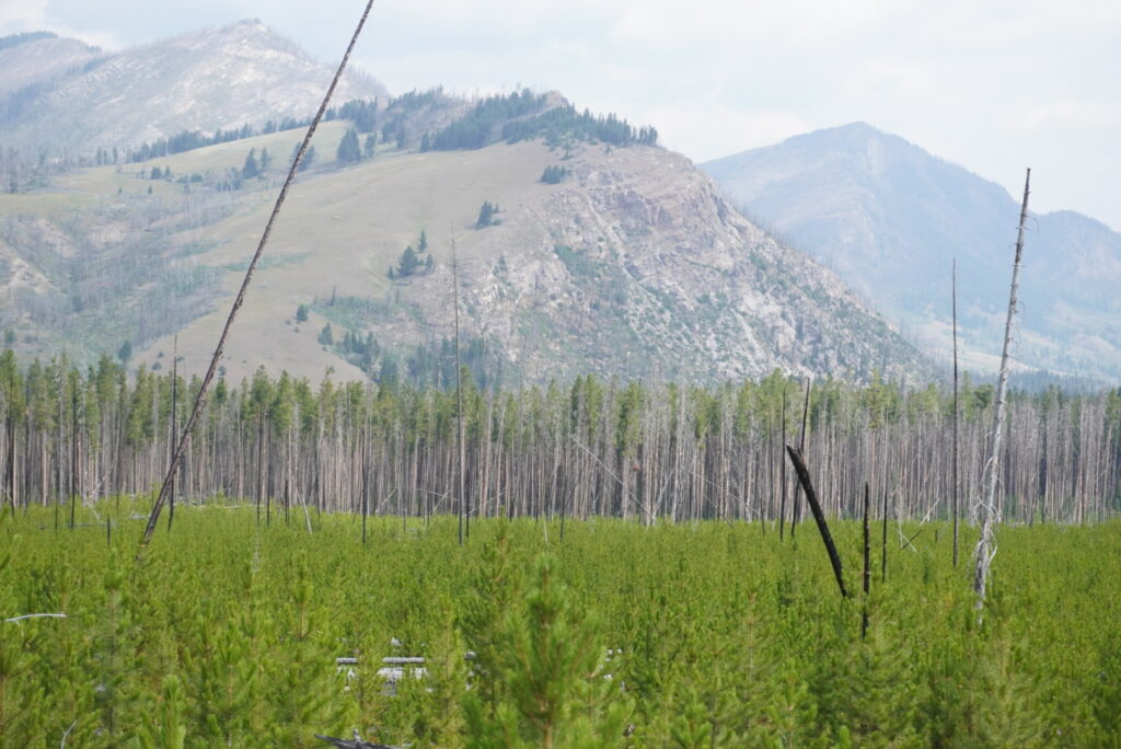
After our hardest day on the trail yet, we hoped that Larch Hill Pass would treat us well. On our way up, we passed through a major burn area which offers little shade from the sun. But regardless the views were still tremendous. Instead of reaching the full height of the pass, we got within about 500 or 600 feet from the top and made a turn left to My Lake. Finally, we were essentially finished with our elevation gain. Crossing over the continental divide for the second and final time, our destination revealed itself.
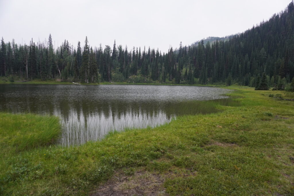

Since there is a camping restriction along the wall, My Lake was the nearest we could get to the Chinese Wall from the north which opened us up to hike the full stretch the following day. The water from the lake was rather murky, but our Platypus filters handled it well. A brave member of our group was nice enough to walk thigh deep into the water to get good fill-ups each time (we couldn’t find flowing water in the area). This spot would serve as the north end of our hike and we were still 25-30 miles from our trailhead. We were ready to slam.
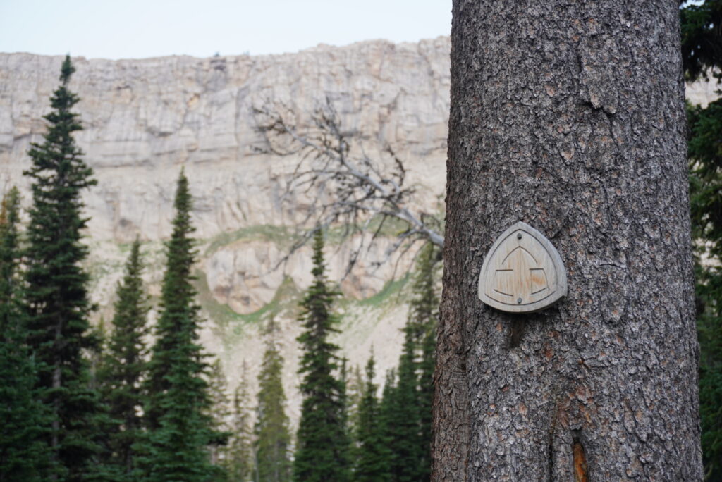
Chinese Wall – Montana
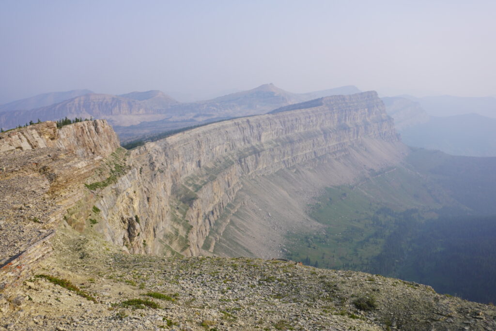
Today, we were set up nicely to hike the entire Chinese Wall. With relatively fresh feet, we woke up early and climbed up and over the remainder of the Larch Hill Pass. The trail quickly met up with the Chinese Wall Portion of the Continental Divide Trail (CDT) I recognized the sign immediately.
We did end up running into some CDTers, and stopped to ask about their journey. Most of these backpackers have definitely been around the block and the CDT is not their first long distance thru hike. Because of our unique starting point for the day, we got a few hours to ourselves in the morning with the incredible panoramic views. The towering wall was even taller looking from down below and dwarfed everything else in comparison.
We passed by Cliff mountain, as well as the first good water source of the day – burnt creek. We were plenty well filled up and continued on our way. The Bob Marshall Wilderness continues to impress us. At one point we noticed a side trail through the trees that lead right up to the wall and we were able to snap some spectacular photos. The Chinese Wall trail turned into the West Fork trail, which led us to our stopping point. I’m getting confused by the north fork, west fork, east fork just writing this. And don’t you forget about the West Fork of the South Fork.
The rest of our hike we were focused on getting out to the trail head. We met back up with Indian Creek on the south end of the Chinese Wall and camped in our original spot for our final night before sending it out of there nice and early. When we returned to the front country, we celebrated by grabbing another round of beer and burgers at Buckhorn Bar – 6 days later. It was nice to disconnect for all this time, and my legs felt great after the journey. After this hike, I knew I would be prepared for any backpacking trip thrown my way.
Before doing this hike, check in on which ranger district(s) you will be hiking in, such as Lewis and Clark or Rocky Mountain.
Thank you for reading all about our trip to the Chinese Wall. I hope to see you out there soon!